deutsch
italiano
Search accommodation Search
Favourites
()
Hike from Plan to the Malga Lazins

Finally out again, finally on holiday!

Rediscover South Tyrol - holidays with a short journey

Everything we love #everythingwelove

Pfelders/Plan in Passeier

A natural gem at the end of the Passeier Valley

Pfelders (1,622 m) is an idyllic mountain village at the end of the Passeier Valley, nestled in the Texel Group. The car-free village is an ideal starting point for challenging hikes in the Texel Group Nature Park. Highlights include the Spronser Lakes Circular Trail (the largest high alpine lake district in the Alps), the Stettiner Hut and the Lazinser Almen. Untouched nature and unspoilt mountain farming culture make Pfelders an insider tip for nature lovers.

Active in Pfelders

  • The Spronser Lakes
    The Königstour leads to the Spronser Lakes – ten high alpine lakes form the largest lake district in the Alps. The challenging circular route (6-7 hours) requires stamina, but rewards you with turquoise mountain lakes and spectacular views of the Ötztal Alps.
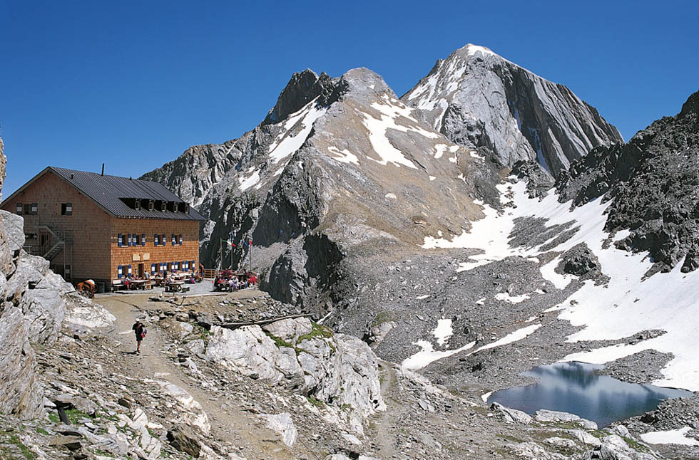
  • Stettiner Hut and Eisjöchl
    The hike to the Stettiner Hut (2,875 m) at the foot of the Hochfeiler is a classic. Experienced mountaineers can conquer the Eisjöchl (3,008 m) and experience the glaciated high mountain world.
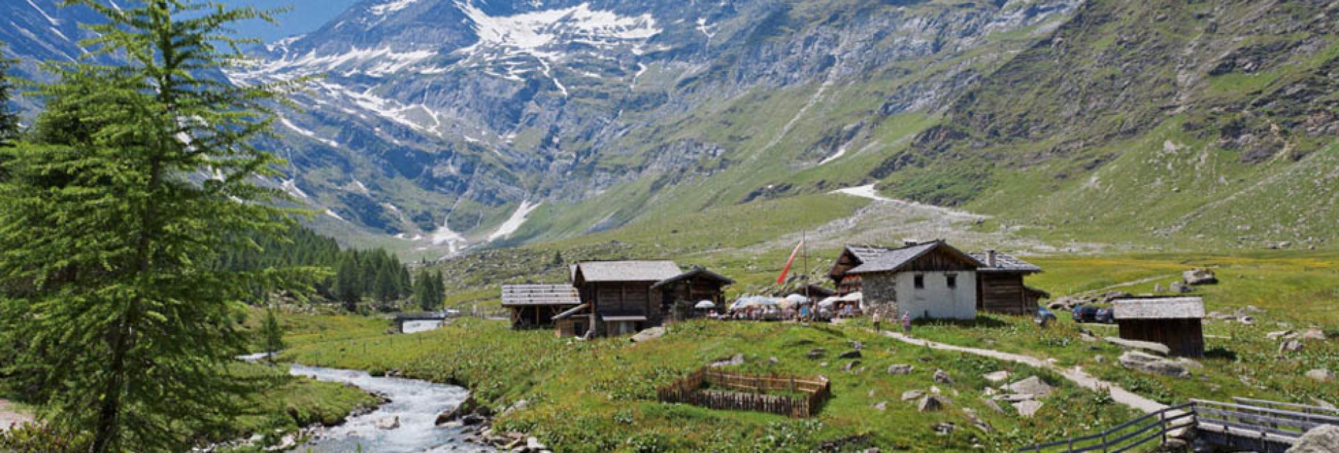
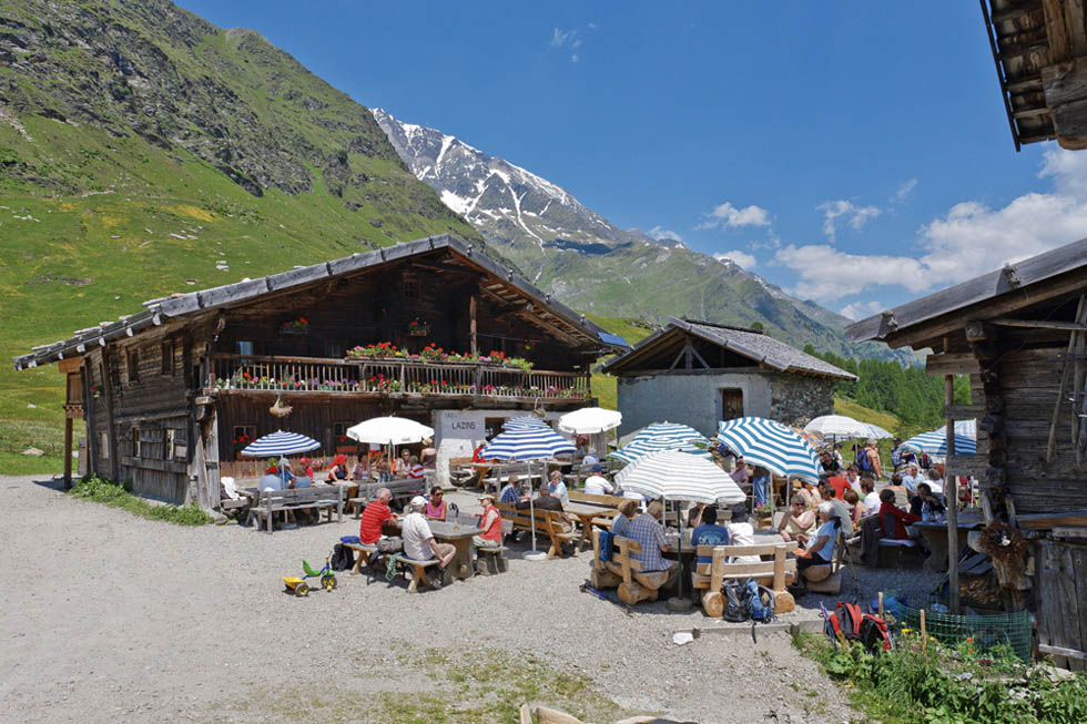
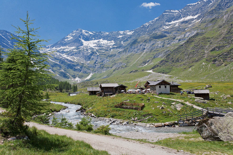
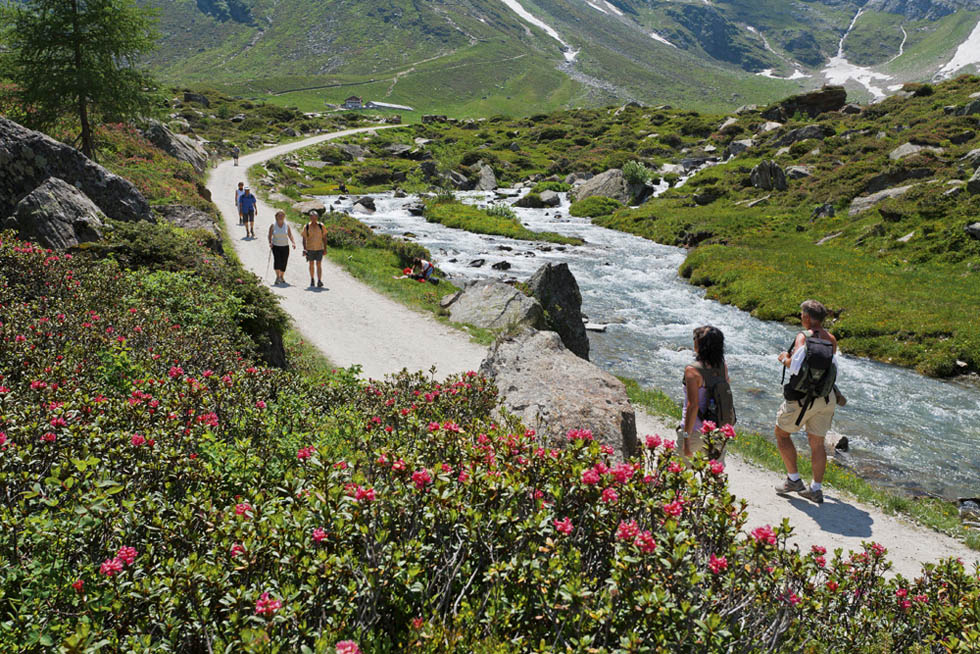
  • Lazinser Alm and Faltschnal
    The Lazinser Alm is a more leisurely destination offering traditional South Tyrolean specialities. The Faltschnaltal valley attracts visitors with its rushing waterfalls and picturesque Faltschnalsee lake.
  • Winter
    In winter, Pfelders becomes a paradise for ski tourers and snowshoe hikers – untouched slopes far away from the crowds.

Authentic mountain village life

Pfelders has retained its original character. The few farms blend harmoniously into the landscape. The car-free village (only electric buses) exudes timeless tranquillity.
Texel Group Nature Park: Pfelders is located in the Texel Group Nature Park, one of the largest protected areas in South Tyrol. Ibex, chamois and marmots are just as much at home here as rare alpine flowers.
Cuisine: The inns spoil guests with authentic South Tyrolean cuisine: Schlutzkrapfen, bacon dumplings and Kaiserschmarrn made from regional products, served with warm hospitality.

Is the whole of Pfelders car-free 🚙🚫?

Yes — Pfelders is not completely car-free, but there are strict traffic restrictions in place.

Here are the details:
Since 26 December 2007, Pfelders has been an official traffic-calmed zone. Only locals and overnight guests are allowed to drive into the town centre. Guests are given a code with their booking confirmation, which allows them to drive to their hotel.

All other visitors (e.g. day visitors) who are not staying overnight in the town must park their cars at the entrance to the town. From there, they can continue by bus, shuttle or on foot.

⚠️ Restrictions / Special features

  • There is a large car park at the entrance to the village of Pfelders, which is subject to a charge.
    Merano and Environs
  • There is a special rule for cable car users: those who take the cable car can park their car at the entrance to the village and, under certain conditions, receive a parking permit or concessions.
  • Guests are therefore allowed to bring what they need by car (e.g. luggage), but this means that the level of traffic in the village is very low. Car traffic within the village centre is kept to a minimum.

Can you ski in Pfelders ❄️?

Yes — Pfelders is a great place to ski.

  • Slopes: approx. 18 km (5 km easy, 12 km intermediate, 1 km difficult)
  • Altitude: 1,600 – 2,502 m
  • Lifts: 4 (including a modern chairlift with heated seats)
  • Extras: Night skiing on Thursdays, ski school & hire on site
  • Special feature: Very family-friendly, with practice lifts and a separate children's area

👉 Conclusion: A compact but versatile ski resort – perfect for families and beginners, but also offering variety for experienced skiers.

⛰️ How difficult is the Spronser Lakes Trail?
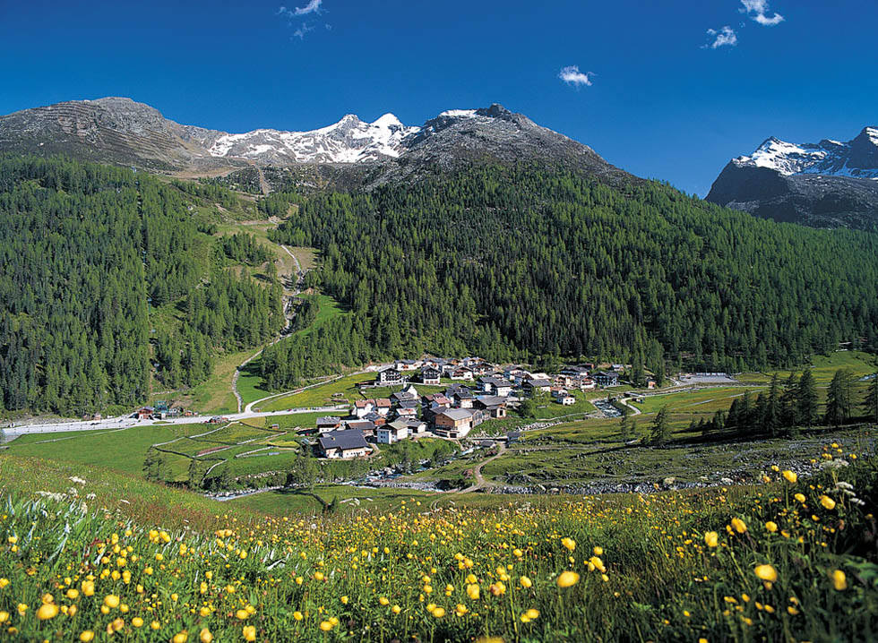
The Spronser Lakes Trail is one of the more challenging mountain tours – here is the most important information about its difficulty:

⛰️ Difficulty & requirements

  • The trail leads through high alpine terrain with some steep ascents and steeper descents.
  • In some places there are exposed passages, secured with ladders or iron chains. This means that a head for heights and sure-footedness are essential.
  • Good physical condition is a prerequisite, as there are many metres of altitude to overcome (ascent and descent often over 1,100-1,300 metres) as well as technically demanding sections.

Pfelders/Plan Pfelders/Plan[1/5]
Malga Lazins – mountain hut Malga Lazins – mountain hut[2/5]
Malga Lazins – mountain hut Malga Lazins – mountain hut[3/5]
Mountain tour from Plan to the Rif. Petrarca hut Mountain tour from Plan to the Rif. Petrarca hut[4/5]
Alpenrose blossom at Passeiertal Alpenrose blossom at Passeiertal[5/5]
To Top

home

search

Favourites list

favourites

more